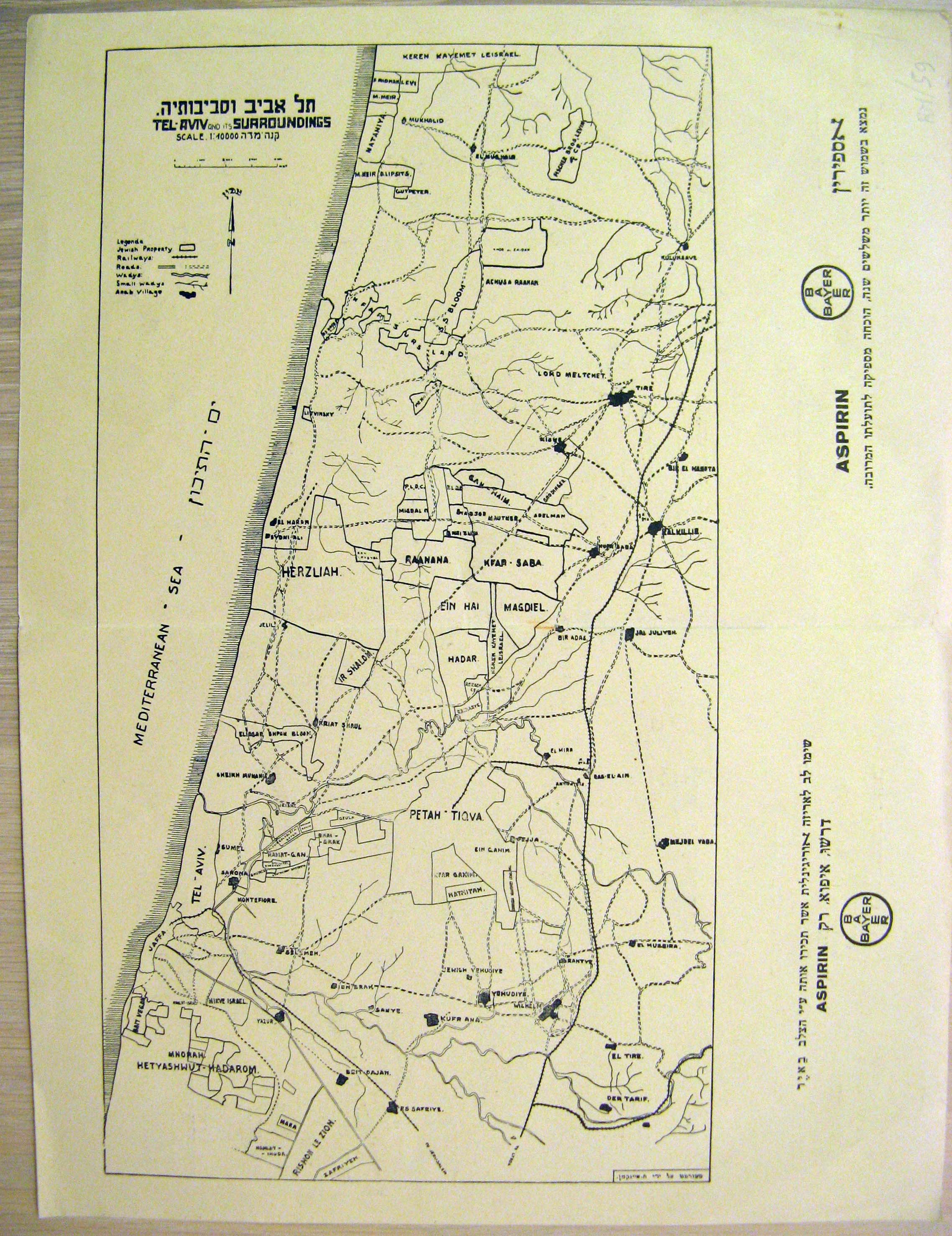
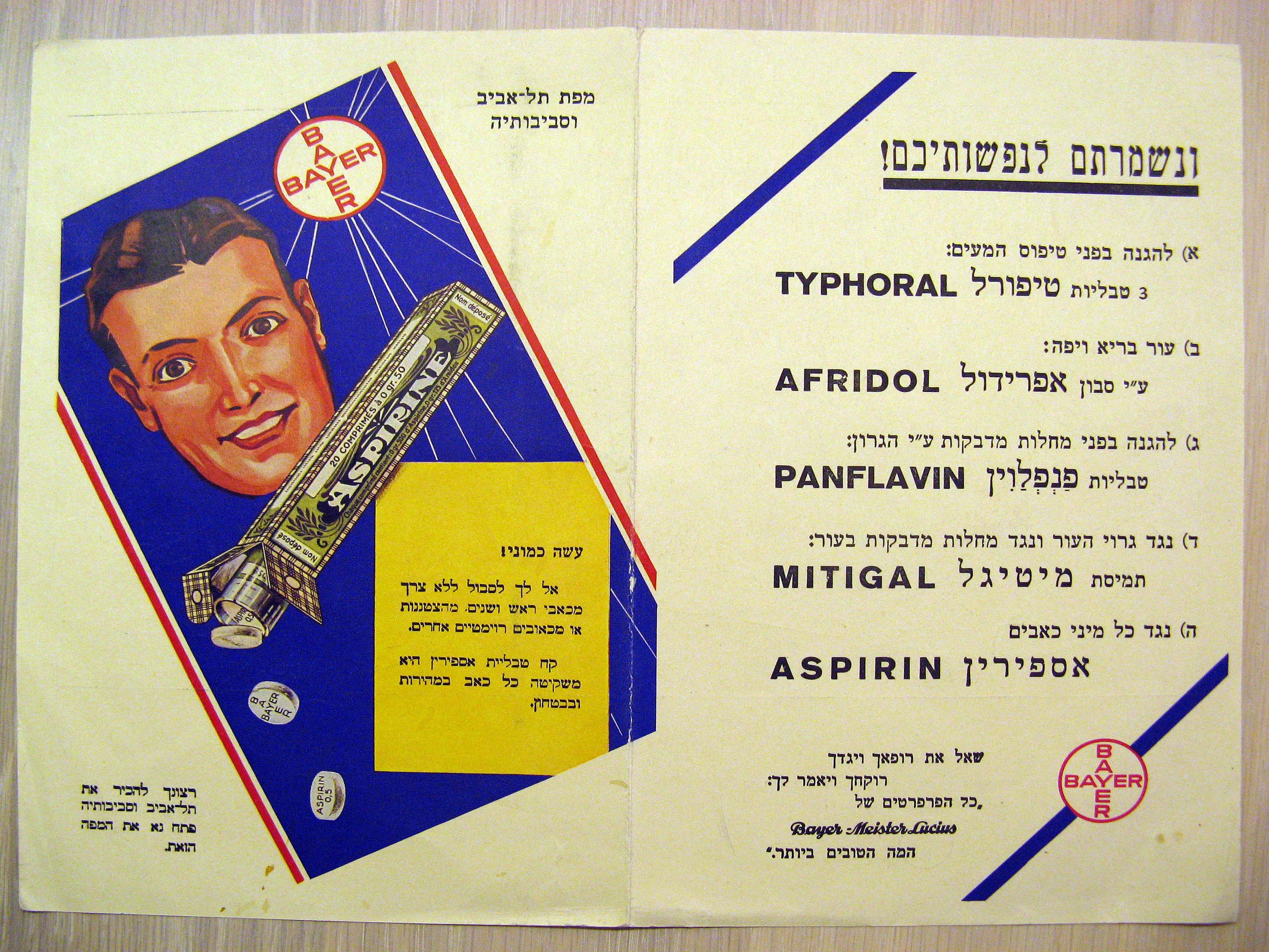
A map of city of Tel Aviv and its larger environs (Gush Dan / Ha-Sharon), from Rishon Le-Zion in the south to Netanya in the north. Printed by the Bayer pharmaceutical company sometime prior to 1936, advertising its flagship brand "Aspirin". It marks the rough municipal boundaries of each city/settlement, as well as roads, railways, waterways, and prominent Arab villages. The map is in English. [VERSO:] An advertisement for Bayer company`s products, particularly Aspirin, in Hebrew.